Location
Gainesville, FL
Client
Alachua County
Market
Services
the brief
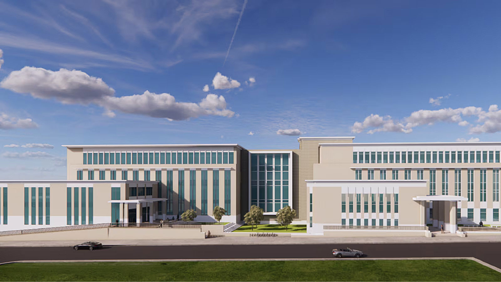
In addition, the project includes a five-story parking garage that will provide approximately 700 spaces. Designed with the community in mind, the garage will also feature public restrooms, a dedicated activity space, and a street-level art walk. This portion of the project is estimated at $12.5 million.
This major Alachua County project will significantly expand the courthouse complex in downtown Gainesville. At the heart of the project is a new 87,000-square-foot civil courthouse building, located next to the existing criminal courthouse. The new facility will consolidate several county departments into one modern, centralized location. The estimated construction cost for the courthouse is $70 million.
To meet the complex’s long-term energy needs, a $6.3 million chilled water central energy plant will also be constructed. This facility will use an energy-efficient ice thermal storage system to provide heating and cooling for both current and future buildings on the site.
services provided
Engineering
- Master Planning for proposed improvements within an existing site in downtown Gainesville.
- Full construction plans for engineering site design, including detailed utility plan and paving, grading, and drainage plan.
- Major modifications to the existing St. Johns River Water Management District Individual Environmental Resource Permit for the site, including preparation of stormwater calculations demonstrating compliance with the master drainage system
- Designed and permitted utility improvements with GRU, including electric, water, and sewer services for each building.
- Prepared and submitted 2 major and 1 intermediate development plan application package to City of Gainesville, obtaining approval from Development Review Board.
- Provided construction administration services
Planning
- Prepared and submitted a Right-of-way vacation for two roadways internal to the site for approval by the City Commission.
- Prepared an amendment to the existing Planned Development Zoning, including new conditions that better reflect present circumstances, including existing site conditions, the updated City of Gainesville Land Development Code, and proposed future development by Alachua County on the property of an additional courthouse, parking garage, and energy facility. This was presented to the City Plan Board and City Commission for approval.
Surveying
- Specific purpose survey- locating additional storm sewer structures and a sanitary sewer line
- Specific purpose survey- utility location to supplement survey by others
- Finished floor elevations of existing courthouse building